Celaya to Totonicapán
Totonicapán → CelayaFTL freight transportation service between Celaya and Totonicapán. Reliable logistics solutions for your business.
Route Description
Everything you need to know about the corridor Celaya - Totonicapán
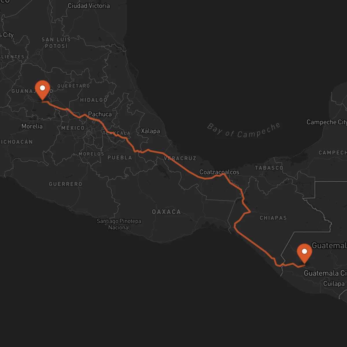
The Celaya to Totonicapán corridor represents a vital cross-border logistics link connecting central Mexico's industrial heartland with Guatemala's western highlands. Spanning approximately 1,179 kilometers, this route serves as a critical conduit for trade between two dynamic economic regions, facilitating the efficient movement of goods across the Mexico-Guatemala border. The strategic importance of this corridor lies in its ability to bridge major production zones in Guanajuato with consumption and distribution centers in Totonicapán, supporting regional supply chains and economic integration.
Economically, the corridor traverses regions with distinct but complementary industrial profiles. In Mexico, the Bajío region, including Celaya, is renowned for its robust manufacturing sector, particularly in automotive parts, food processing, and light industry. Guatemala's western highlands, where Totonicapán is located, are characterized by textile manufacturing, agricultural production (including vegetables and fruits), and growing consumer goods demand. This creates a consistent flow of finished goods, raw materials, and specialized cargo in both directions, making the corridor a steady artery for cross-border commerce.
Key industries leveraging this route include automotive suppliers shipping components, food and beverage companies moving processed goods and ingredients, textile manufacturers transporting fabrics and finished apparel, and agricultural exporters handling perishable produce. The corridor's utility is enhanced by its alignment with major transportation infrastructure. In Mexico, the primary artery is Federal Highway 57 (México-Querétaro), a modern, high-capacity toll road connecting to the broader network. Upon crossing into Guatemala via the Tecún Umán border crossing, the route continues on the CA-1 highway, which is the main coastal highway serving the western region and providing access to Totonicapán's mountainous terrain.
The Tecún Umán/El Carmen border crossing is the pivotal point for this corridor. Navigating customs and border procedures efficiently requires expertise in both Mexican and Guatemalan regulations, as well as familiarity with programs like C-TPAT and FAST for expedited clearance. Control Terrestre facilitates seamless operations on this corridor through our strategic alliance of certified transportation providers. Our partners hold key credentials including C-TPAT, FAST, BASC, and Clean Transportation, ensuring compliance and security. We coordinate dedicated FTL services, including dry vans, reefers for temperature-sensitive goods, and flatbeds for oversized equipment, managing all cross-border documentation and customs brokerage coordination. Our focus is on providing a single, human point of contact to optimize your supply chain across this complex international route, leveraging our network's local expertise and green transportation practices.
Services for this Route
Available services for the corridor Celaya - Totonicapán
 Origin
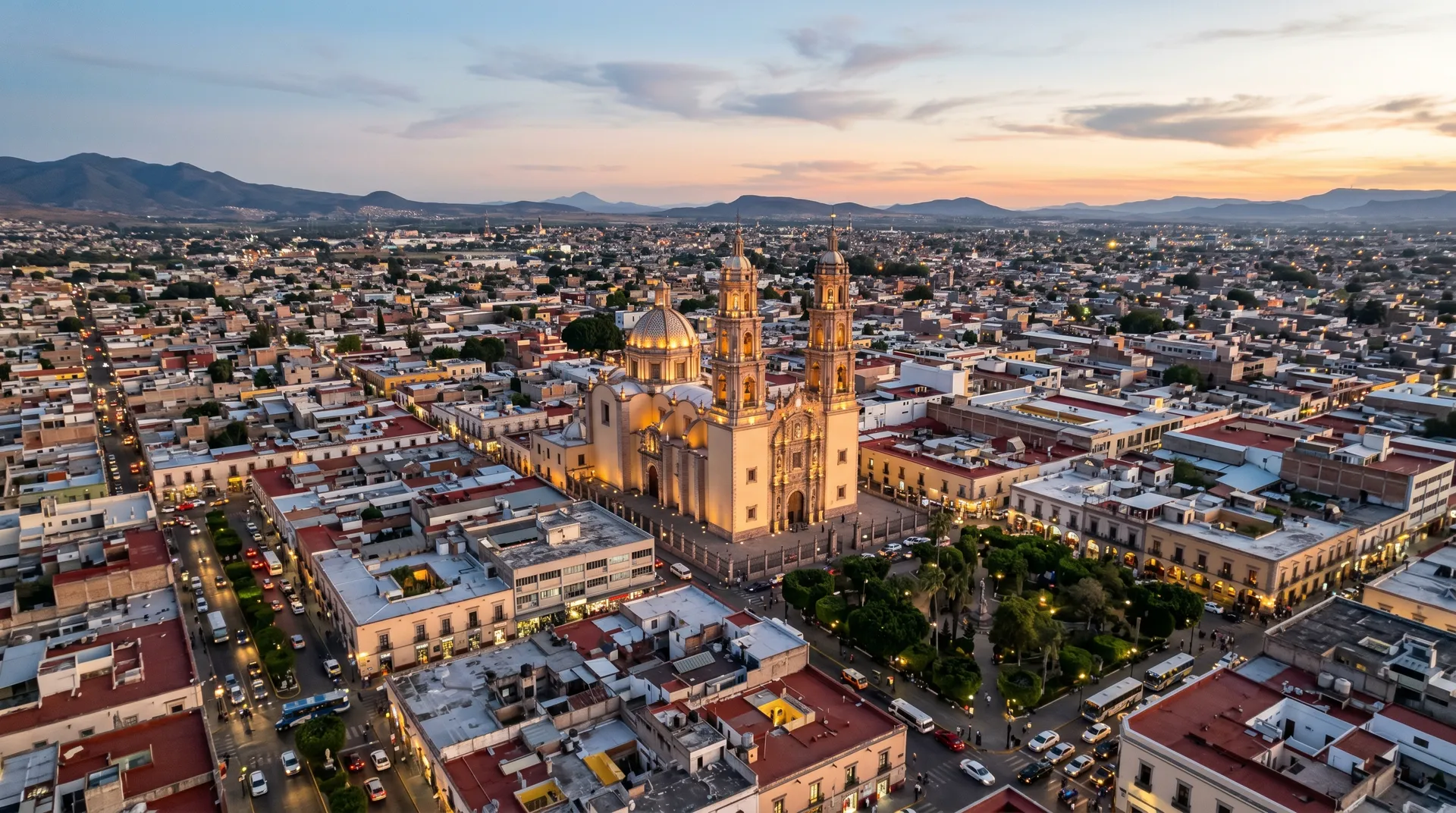
Celaya
Celaya, located in the state of Guanajuato within Mexico's Bajío region, is a strategic logistics hub due to its central position in the country's industrial corridor. It sits at a critical junction of Federal Highway 57, the primary north-south artery connecting Mexico City to the U.S. border, and Federal Highway 45, providing direct east-west access. This connectivity, combined with its proximity to the industrial hubs of Querétaro and León, makes Celaya an ideal origin point for distribution across Mexico and into Central America. The city is a major manufacturing center, particularly strong in automotive parts (with a significant presence of Tier 1 and 2 suppliers), food processing (notably for bread and confectionery), and metal mechanics. Its infrastructure includes well-developed warehousing and distribution facilities, rail intermodal options, and direct access to the port of Veracruz for maritime connections, solidifying its role as a key multimodal logistics node.
 Destination
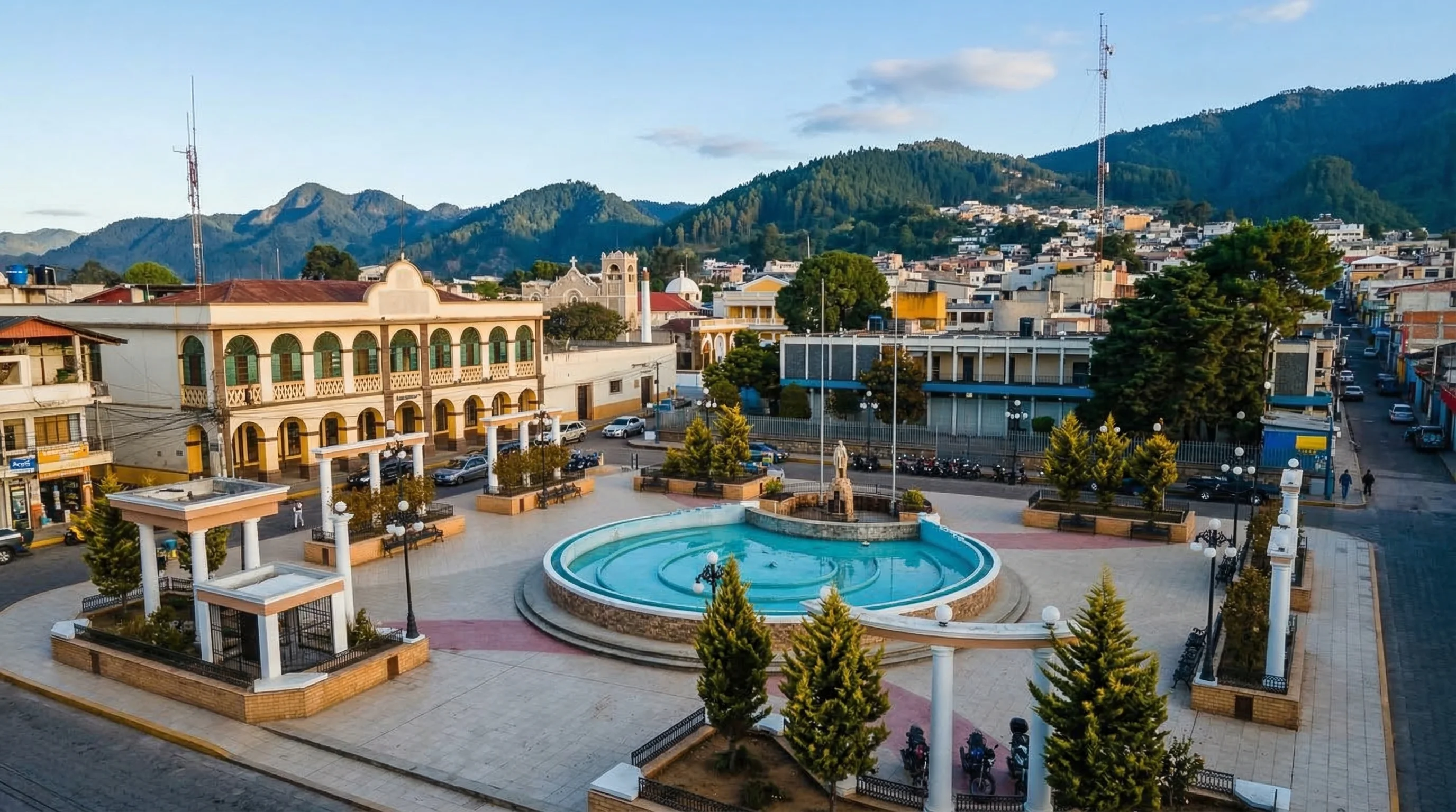
Totonicapán
Totonicapán, the capital of the department of the same name in Guatemala's western highlands, is a strategically important destination due to its role as a commercial and administrative center for the region. Its location provides access to the densely populated highland areas and serves as a distribution point for the surrounding agricultural and artisanal zones. The main economic sectors driving freight demand here are textile and apparel manufacturing, agricultural production (including potatoes, carrots, and other cool-climate vegetables), and consumer goods distribution. The primary transportation infrastructure is the CA-1 highway (Carretera Panamericana), which runs along the Pacific coast and connects through mountain passes to Totonicapán. While the terrain presents challenges, this highway is the essential freight corridor linking the department to the rest of Guatemala and the Mexico border. Local distribution relies on a network of secondary roads, requiring carriers with experience in varied topography.